 1 month ago
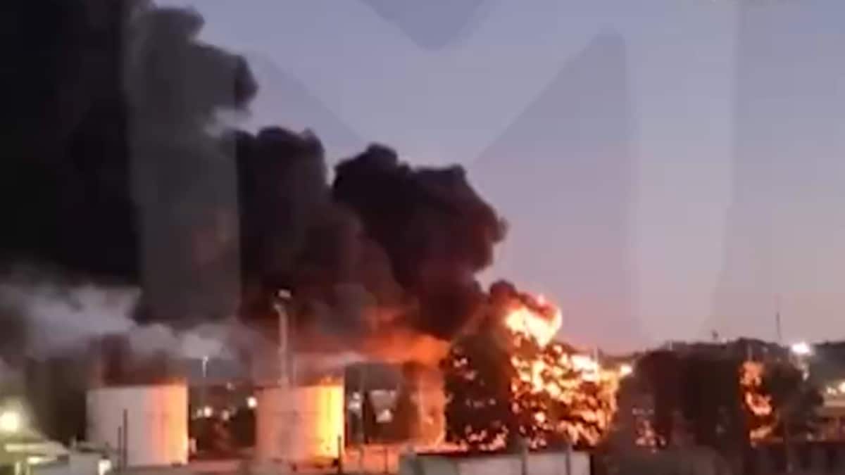
High-resolution satellite images released by US-based Earth imaging company Maxar Technologies revealed visual evidence of the destruction caused by Israel's Operation Rising Lion against Iran—a targeted military operation to roll back the Iranian threat of nuclear weapons.
Israel continues to strike multiple sites across Iran for the third day, prompting retaliatory attacks in response.
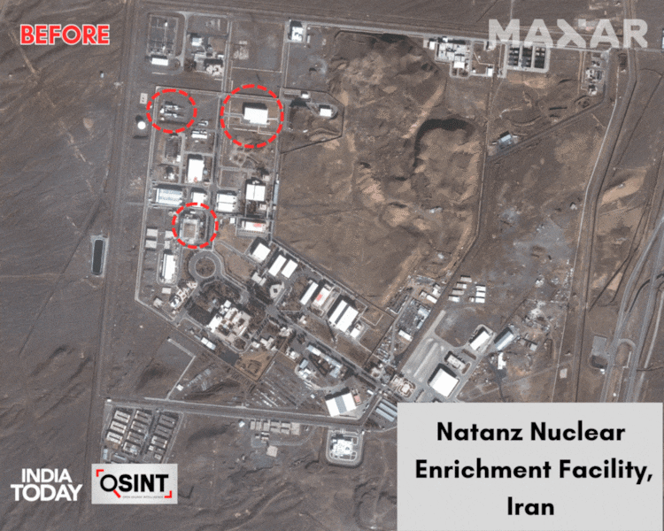
Newly released satellite imagery from Maxar provides the clearest view yet of the aftermath at key Iranian nuclear facilities in Natanz, Isfahan, and other strategic locations in Tehran and Piranshahr.
At Natanz, damage to the pilot fuel enrichment plant and an electrical substation can be seen, according to analysis by the Institute for Science and Security (ISIS).
On Friday, the head of the Atomic Energy Agency(IAEA), Rafael Grossi, told the UN Security Council that "the above-ground part of the pilot fuel enrichment plant, where Iran was producing uranium enriched up to 60% U-235, has been destroyed." Uranium-235 is essential both for nuclear power stations and also for nuclear weapons.
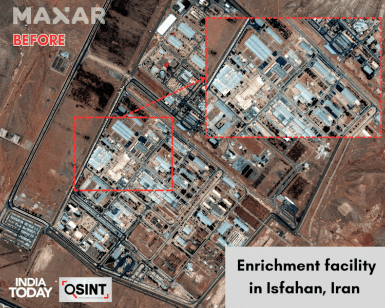

Optical satellite imagery shows visible damage to at least two structures at Isfahan.
The IAEA has said that "no increase in off-site radiation" has been recorded at either Natanz or Isfahan.
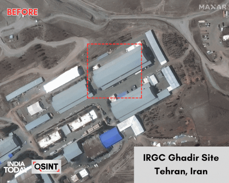
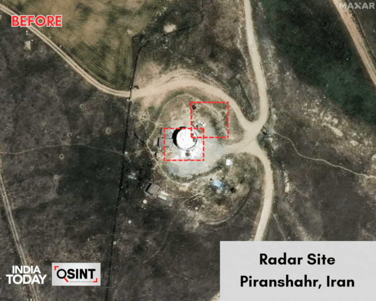
Satellite imagery accessed from Maxar also shows significant damage to one structure at Iran's Islamic Revolutionary Guard Corps (IRGC) Ghadir ballistic missile base near Tehran, and considerable damage to the IRGC radar site in Piranshahr in West Azerbaijan Province.
Published By:
Shipra Parashar
Published On:
Jun 15, 2025
Tune In